NASA warns 2026 El Niño is 'catching up' on one of history's worst after releasing bold new images

Topics: Nasa, Weather, World News, News, Environment
 Rhianna Benson
Topics: Nasa, Weather, World News, News, Environment
Startling new satellite images have led scientists to believe that the incoming Super El Niño could be more impactful than ever before.
For reference, the phrase describes a continuous period of warmer-than-usual sea surface temperatures across the waterway. What makes this one especially 'Super' is that temperatures are expected to reach an especially high level, between 1.5-2 degrees Celsius higher than average.
The strongest El Niño on 20th century records occurred between 1997 and 1998, having been triggered by a wide range of natural disasters occurring across the globe - especially drought and flooding.
The 2026 El Niño that experts believe will emerge in the coming months - and could be lurking in the Pacific Ocean - is expected to break that record.
Advert

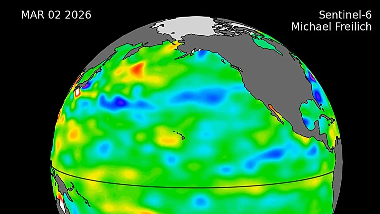
Waves of higher, hotter water that we've ever seen are visible in newly collated satellite data, which shows it moving eastward across the Pacific.
The sea level data was released this week by NASA and ESA (European Space Agency), showing a sizeable swell of warm water having recently arrived off the coast of South America that reportedly indicates the wave's imminent arrival.
The Sentinel-6 Michael Freilich satellite was first launched in 2020 and serves to measure water height for the entire Pacific every 10 days, right down to the inch, and tracks what are referred to as 'Kelvin waves'.
These are essentially pools of water within the ocean that reach 13.5 degrees Fahrenheit above average. Mostly, this water accumulates off the shores of Colombia, Ecuador, and Peru.
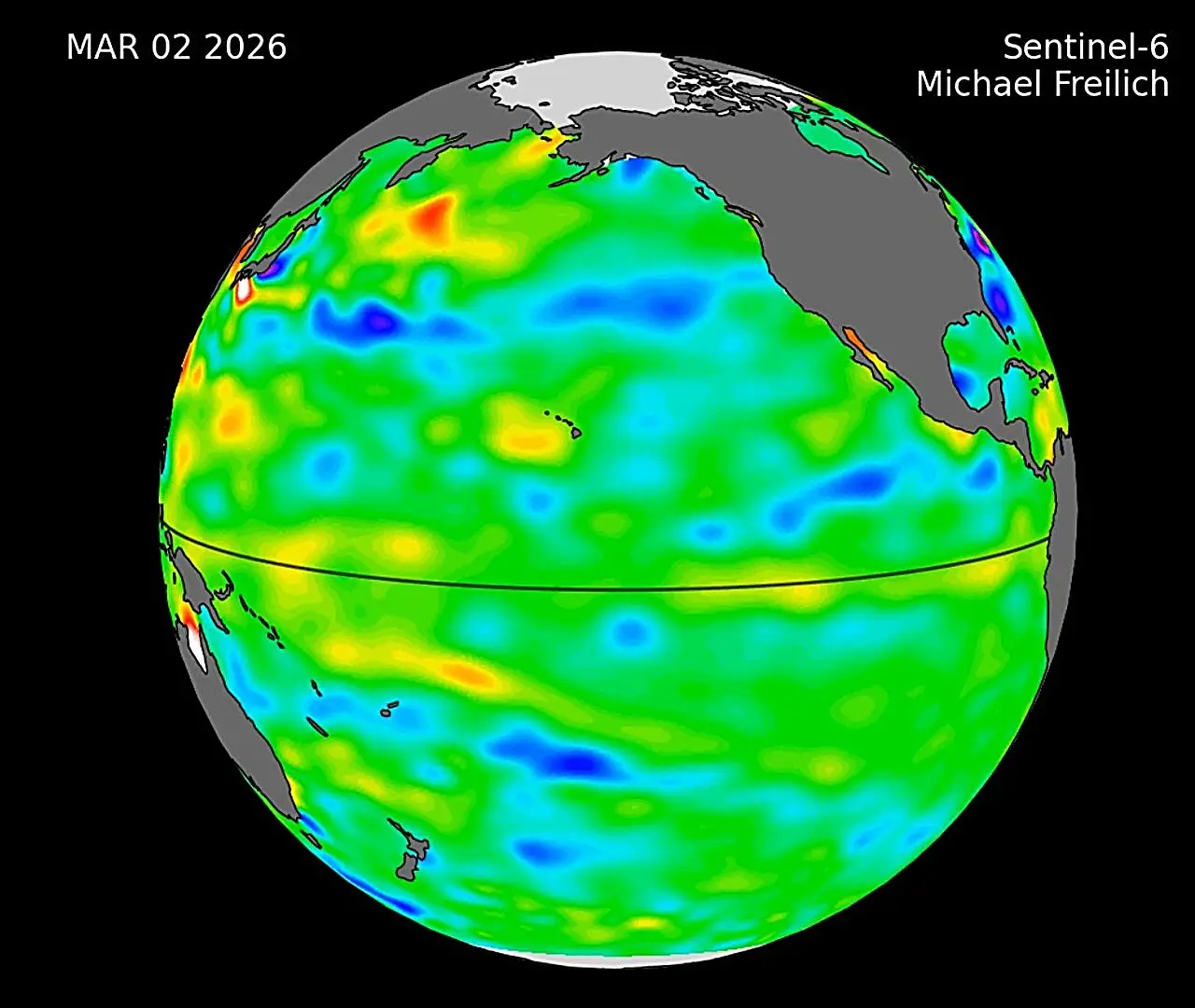
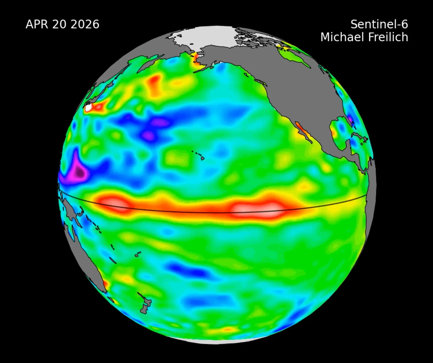
Already increased temperatures have been demonstrated by a rise in the elevation of an area of the ocean, a result of water warming when it expands.
Images showed that a small Kelvin wave had already formed around Micronesia back in January. It had dissipated by mid-February, however. Another wave was then recorded in March, which slowly moved east.
By mid-May, the seas surrounding Peru were over 5.9 inches deeper than the average.
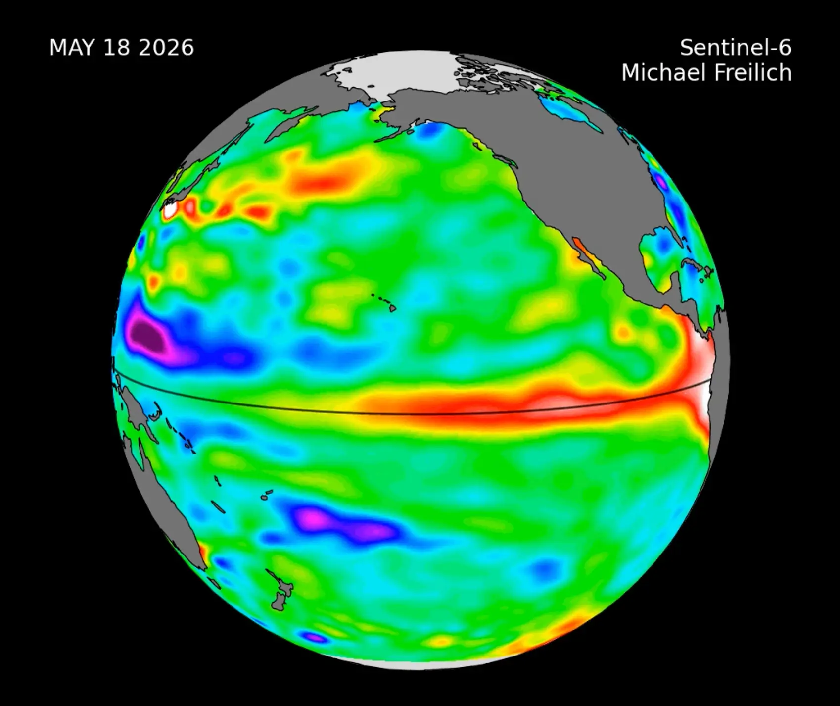
Josh Willis, a sea-level researcher at NASA's Jet Propulsion Laboratory in Southern California and project scientist for Sentinel-6 Michael Freilich, declared of this finding: "While this year's event started a bit later than the big El Niños of 2015 and 1997, it's beginning to catch up."
He went on to add: "We'll see how big it gets."
This year's El Niño will likely result in heavy precipitation in some regions and major rain deficits in others, which will undoubtedly have an impact on both well-being and commerce.
Also noting the wave's significance, National Oceanic and Atmospheric Administration’s Climate Prediction Centre researcher, Michelle L’Heureux, told The Washington Post: "The current Kelvin wave is impressive and, by some measures we look at, it is rivalling the one we saw in 1997."
Pointing out that Kelvin waves are driven by wind bursts, which push warmer waters from west to east, experts at Severe Weather added: "This is a direct example of how the atmosphere can drive ocean changes."
Strap in, folks. It’s time for some science.
It all starts with something called trade winds, which are permanent winds around the equator which usually blow from east to west. So in the equatorial Pacific, they blow from the Americas towards Australia and New Zealand.
As the wind blows the water east, it is warmed by the sun, so by the time it gets to the other side of the Pacific, the warm water causes hot air to rise, leading to warm, wet and unsettled weather. Meanwhile, colder water from deeper in the ocean rises in the east to replace the water blown west.
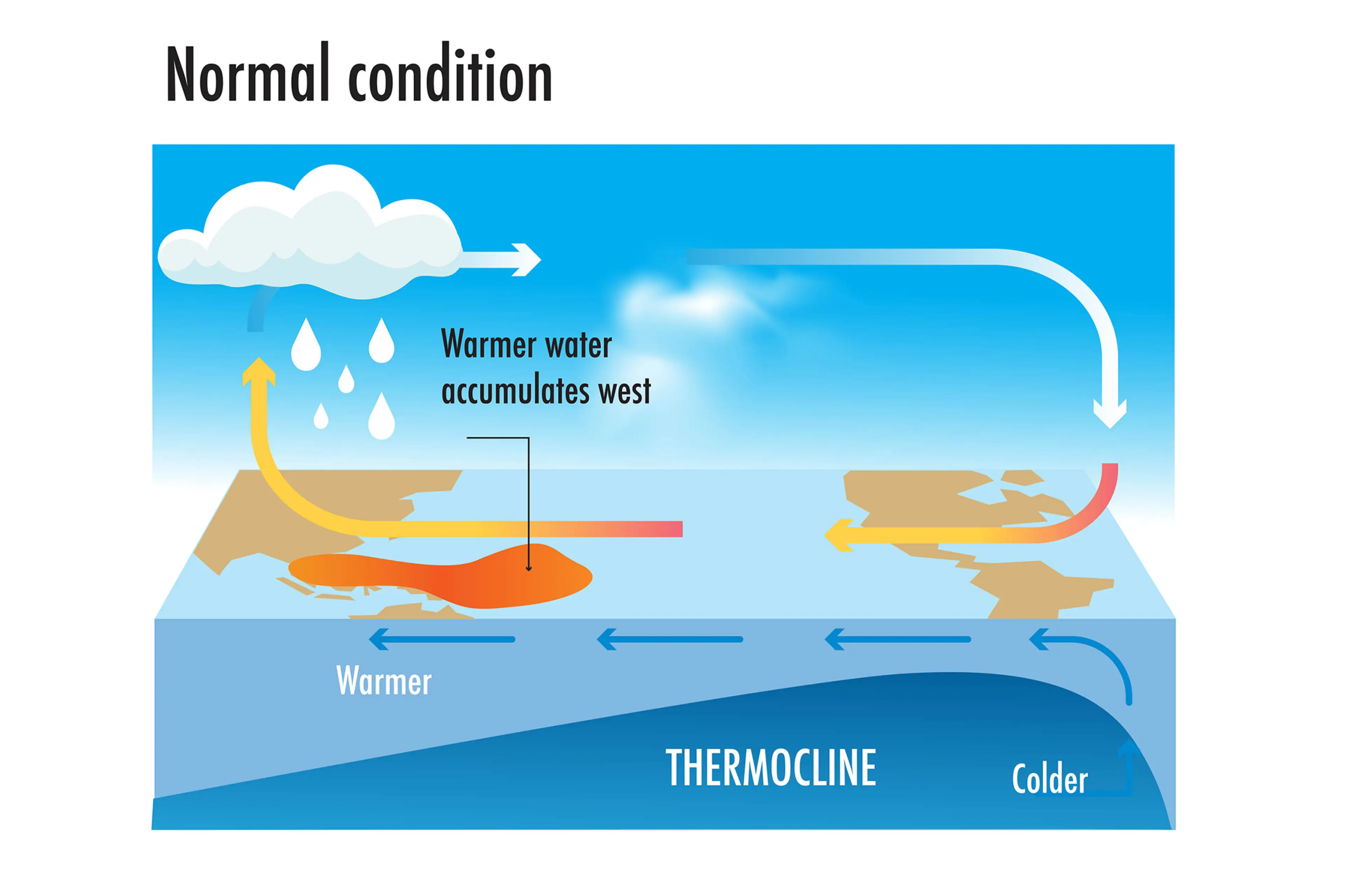
But during El Niño years, this gets disrupted.
When trade winds are weakened or even reversed, the temperature difference between the east and west is cancelled out, and usually cold parts of the ocean warm up.
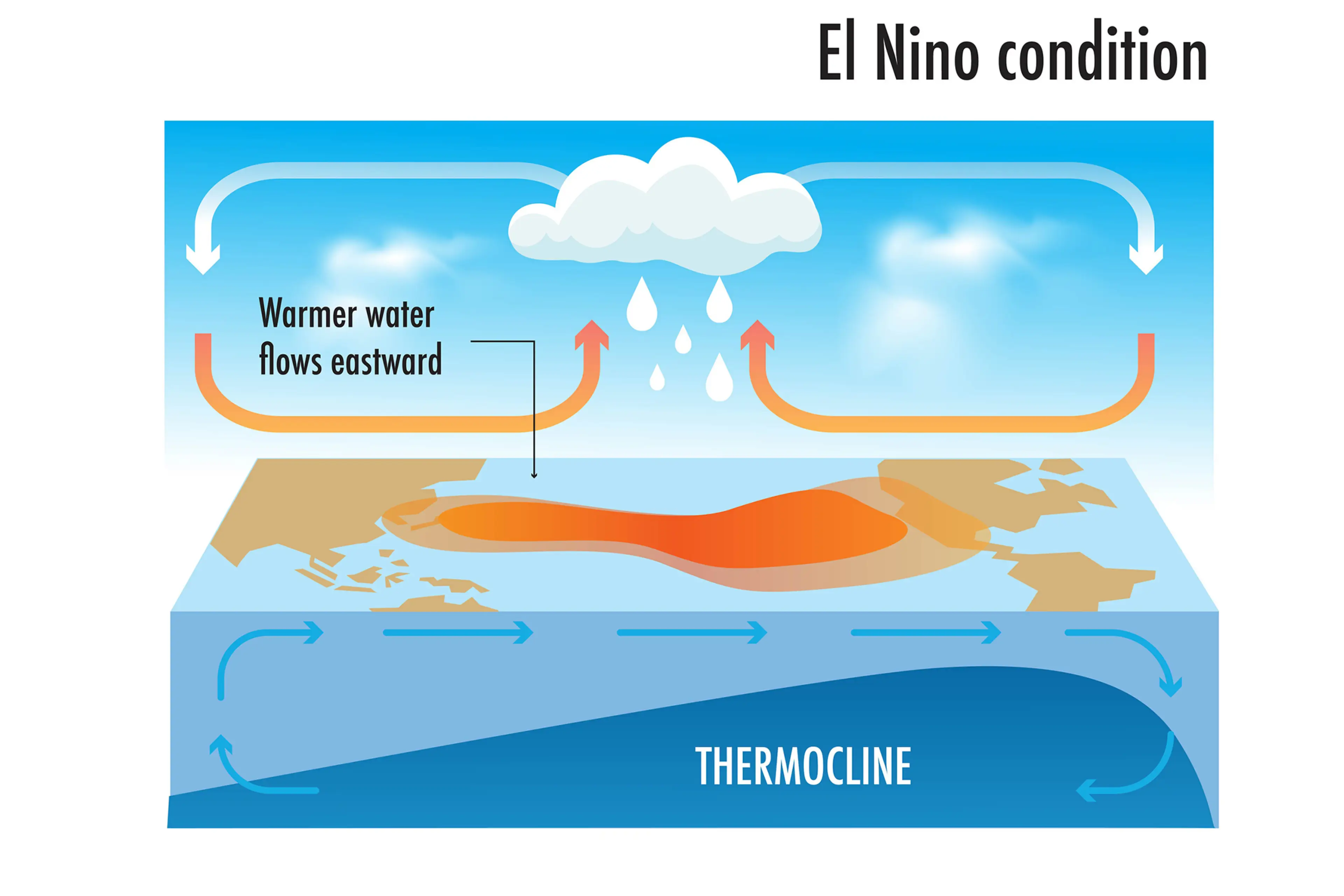
Rainfall and wind patterns change across the equatorial Pacific, which has a knock-on effect around the world.
Anyone else's head hurt a bit?